


Local Forecast
Indianapolis Area
![]() TONIGHT
TONIGHT
Tonight Mostly clear through the late overnight, then becoming partly cloudy. lows in the upper 50s. northwest winds around 5 mph through the late overnight, becoming light and variable.
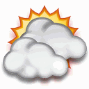
![]() SUNDAY
SUNDAY
Sunday Partly cloudy through early afternoon, then mostly cloudy with scattered showers and thunderstorms late in the afternoon. some thunderstorms may produce heavy rainfall late in the afternoon. highs in the upper 70s. southeast winds 5 to 10 mph. gusts up to 20 mph late in the afternoon. chance of rain 40 percent.
Visibility: 10 mile(s)
Cloud Base Height: 4791
Record readings this month:
Coldest Day 65.9°F on: Jun 15 2026
Coldest Night 62.2°F on: Jun 15 2026
Warmest Day 82.6°F on: Jun 10 2026
Warmest Night 80.6°F on: Jun 11 2026
Record readings this year:
Coldest Day 4.3°F on: Jan 26 2026
Coldest Night 3.0°F on: Jan 24 2026
Warmest Day 82.6°F on: Jun 10 2026
Warmest Night 80.6°F on: Jun 11 2026
Trends:
Temperature change in the last 24 hours: +0.9 °F
Humidity change in the last 24 hours: -3 %
Wind change in the last 24 hours:0.0 mph
Rain change in the last 24 hours: 0.000 .in
Barometer change in the last 24 hours: -0.050 .in
New Moon 02:55 UTC June 15 2026
First Quarter 21:56 UTC June 21 2026
Full Moon 23:57 UTC June 29 2026
Last Quarter 19:30 UTC July 7 2026
Phase 41%

Currently 1 consecutive days without rain